This hike was the first thing in 2016. It started from Griffith Observatory, and there are plenty of parking there. From the trail in the observatory, you can reach the peak shortly. There after you can go back or heading to Hollywood sign. I actually took a wrong way and the went to the opposite site. But the view of the sign from the below was much better. Most of the road to the Hollywood sign is asphalt, and it was so hard to keep walking.
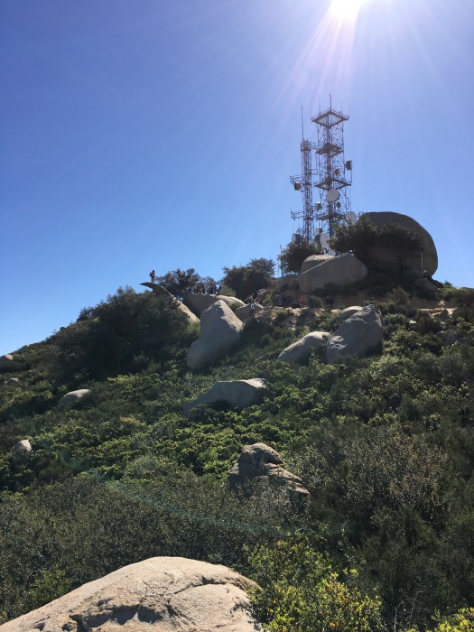
Went to here end of 2015. I enjoyed the hike. There are still many people on the potato chip rock even in week day. You should avoid weekend in order to avoid in the long line to take a picture there. Not many details, but I plan to go here again.
Trailhead: 14644 Lake Poway Road, Poway, CA 92064
Lake Poway
MT Woodson Trail
Tree in the middle
Seen from below
People in potato chip rock
On the potato chip rock
Potato chip rock
Third visit on May 5, 2018:
1:20 for going up, and 1:13 to get down. The weather forecast was not hot day, and started early to avoid excessive sun. I met one gentlemen on way up, and it was very nice to talk him on the trail.
Fourth visit on May 12, 2018
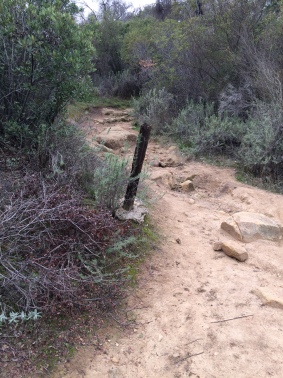
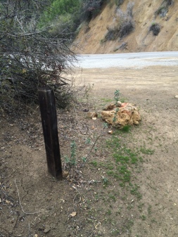
People gathered together on this cloudy day. I was little worried because there was a little rain on the way to the trailhead. We started about 10 minutes late because waiting people to join. The most part of junctions, take a left except the last two junction. If you are not sure where to go, follow the sign that said Mount Woodson Trail. Trailhead elevation is about 950 ft, and the summit where potato chip rock is about 2,846 feet. Total elevation gain is about 2000 ft, less or more depending on your route.
Hours: 3 hours and half ( about 6.25-mile loop with 1,075 feet of elevation gain )
Difficulty: Moderate, the course is not difficult. But, it is because the length of the trail if you choose the longer loop.
Pet-Friendly: Dogs are allowed on leash.
Bike: Not sure, but probably it is not good for bike.
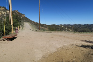
Parking: There is a big parking space on the trailhead. I was there about 10:30 am, no spots. You can park off street parking down the trailhead. There is a restroom in the parking lot, so it is better to do your work before hike.
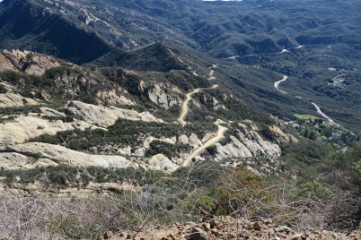
The trail start from the Sandstone peak trailhead, and the sign are very clear. After a third of a mile, turn right on the junction, taking the connection to Mishe Mokwa Trail. Continue on Mishe Mokwa Trail, soon you will see balancing rock at the northwest. I heard people talking nearby, and it was coming from people climbing the cliffs below balancing rock. Soon there is little bit of shading road follows until the picnic area. You can rest a bit in the picnic area which is very nice and can avoid sunshine for a while. Then go pass the area, and continue on Mishe Mokwa Trail, and turn left on the junction.
Trailhead
Sign
The first junction
Take Mishe Mokwa
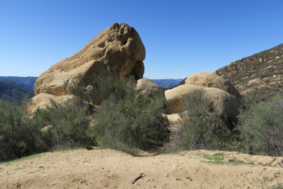
Balancing Rock
Split Rock
Picnic area
Junction
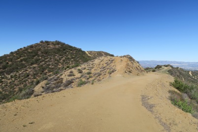
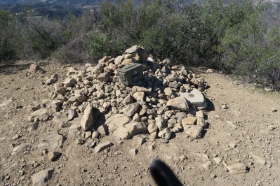
About an hour and little more from the start, you will see two rocky peaks on your right and from there is no shade with some steep road for a while. About 10 minutes, turn left on the junction and continue on Sandstone peak. About 0.6 mile, turn left on the junction. Soon, there is another junction with no sign, here turn left. If you go straight it will end up with one of the peak. Then you see the inspiration point (2800 ft). The view here is really great, and you want to take some picture there. Then there is another junction with no sign, and turn left here. About 2 hour and 10 minutes, arrived at the sandstone peak. There is a register and you can put your name on it.
Two rocky peaks
Junction
Junction
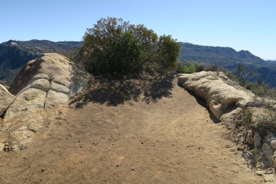
Here is inspiration point
Great view from inspiration point
Some plain before the peak
Finally at the sandstone peak
Some cliff from the peak
Head down to parking lot
On the way to parking lot
Sandstone peak from Yerba Buena
Overall, this is a great hike, and the long walk is rewarded by a lot of great views. If you want to have short hike, you can take right turn on the first junction. This way is actually I go down after reaching sandstone peak.
Hours: 1 hour and half ( about 3.6 miles round trip)
Difficulty: Moderate
Pet-Friendly: Dogs are allowed.
Bike: allowed.
Parking: There is a couple of parking space before stunt high trail. Off street parking on the Stunt Road.
About 0.7 miles from the start there is a junction, and take a left. The right will go to Red Rock Canyon Park. There is a couple rocks on the way, and you might take a rest or take a picture there. Just before the peak, there is nice rest area. Then in a few minutes, the peak is in your left. There is a register bin at the peak.
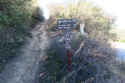
Pet-Friendly: Dogs are not allowed in Saddle Peak Trail
Bike: Not allowed.
Parking: Off street parking on the Saddle Peak Road.
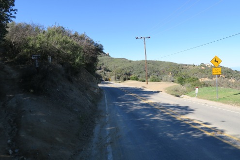
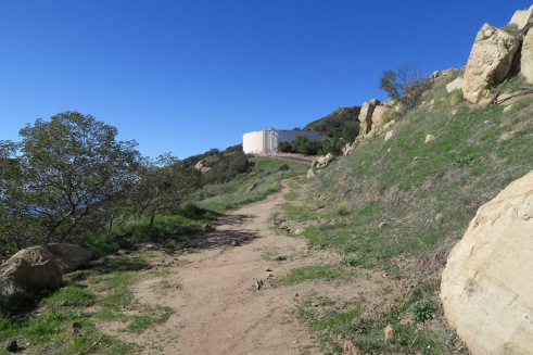
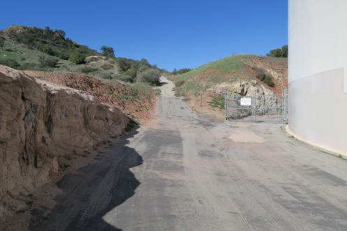
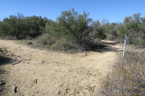
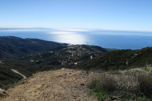
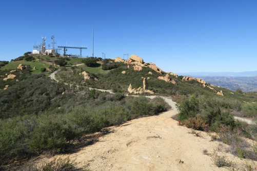
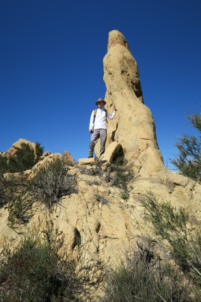
The trail start from the sign Saddle Peak Trail on the Stunt Road. In the junction of Stunt Road and Schueren Road, walk down to west following Stunt Road, and you will see trailhead cross the street. Follow the trail and you will see water tank in your front, and just pass the water tank. Soon, there is a junction, and take a left. Behind the water tank, the trail continues. When you arrive at the top, there are two peaks, left and right. You can view both or one of them. Ocean view is more clear on the left peak because there is no barriers. The other peak is little higher and it has a bunch of antennas. On the way the other peak, there is very nice rock you can take a picture.
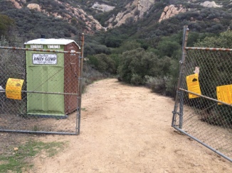
Initially I plan to clime Calabasas Peak from stunt road, but I take opposite trail which is Stunt High trail. This hike is little strange to me, because it ended few times with paved road crossing. And there is no sign where to go.
It started with this fenced gate and it goes little downward and then, it met a junction where take to the left. Then you met the first paved road, which is weird to me. Just go little up to the the road, and cross the road then take trail in the fourth picture. In a about a mile, you will encounter the second paved road. From that point, I completely lost, and get down. You probably go upward following the road, and it will end up with the peak.
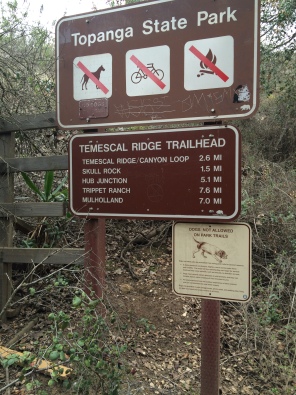
Hours: 2 hours and half, Temescal Ridge ( about 5 miles round trip)
Difficulty: Medium
Parking: Street parking on Temescal Canyon Cyn, and South of Sunset. Also, $7 parking lot inside temescal park.
Pet-Friendly: Dogs are not allowed on Temescal Ridge/Canyon trail, but there are other trails that allow dogs. So watch out the sign in the trail head.
Caution: The stop sign inside the park is photo enforced. Be careful when you see stop sign.